RAOB Integrated Cloud and Precipitation System (RICAPS)
Overview
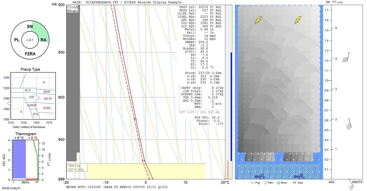
RICAPS not only provides significantly improved cloud analyses, but it also provides precipitation intensity and precipitation type analyses. There is also an option to automatically display a METAR observation at the bottom of each sounding diagram, which combines all available RAOB analyses: including clouds, weather, wind, and temperature elements.
The Details
CLOUDS: RICAPS performs a series of Bottom-Up scans to determine cloud layers. This system is superior to the older, Traditional temperature/dewpoint relationship algorithm, which over-analyzes low clouds and under-analyzes high clouds. The RICAPS cloud algorithm works with any sounding profile and is completely independent of modeled cloud fields. Cloud algorithms use a combination of temperature, dewpoint, relative humidity, wet-bulb & frostpoint temperatures and their associated lapse-rates. RAOB displays these cloud layers in the same fashion as before, including the Toolbar’s “cloud” analyses.
PRECIPITATION: RICAPS also determines Precipitation Type and Intensity.
Precipitation Type is determined using an advanced Top-Down scan methodology. It consolidates the strengths of the commonly used top-down P-Type methods, including the Baldwin, Ramer, and Bourgouin methods. Most importantly, it also eliminates their weaknesses, such as inability to determine precipitation rate, the lack of dry-layer detection and feeder-seeder integration, lack of ability to use humidity for nucleation determination, lack of wetbulb interrogation at key thresholds, and the assumption that ice crystals are always present during the top-down initiation process. In addition to eliminating the above weaknesses, the RICAPS method not only determines the percentage of ice crystals during top-down initialization, but it also continually updates this percentage while scanning downward at 100-foot intervals. Special analyses are additionally performed each time the profile crosses the zero-degree isotherm and at the base of dry-layers. And if a dry-layer is encountered, RICAPS then begins a unique, dual-track, top-down process, which simulates the effects of feeder-seeder processes. RICAPS can be used with any sounding profile and is geographically independent since it can be used at any location and any elevation, unlike the Partial-Thickness nomogram method.
Precipitation Intensity is determined using both Bottom-Up and Top-Down scans of the entire profile. The algorithm uses a combination of cloud layers, relative humidity, and associated temperature and dewpoint lapse-rates.
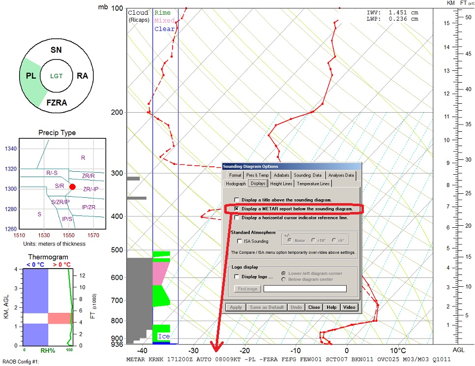
WINTER WEATHER SOUNDING DISPLAY: There are now two Winter Weather sounding diagram displays: the old and the new. The old display will be shown when the old (or Traditional) cloud analysis method is used. The new display will be shown when the new RICAPS cloud method is selected. The same winter precipitation nomograms are shown on the new display, but the Thickness Table is replaced by a new precipitation graphic - the Precipitation Donut.
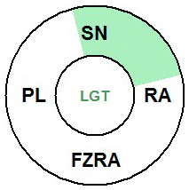
The Precipitation Donut is an interactive, graphic representation of precipitation type and intensity.
The Thickness Table, available with the old Winter display screen, can be seen on the new RICAPS Winter display screen by right-clicking on the “thickness” text.
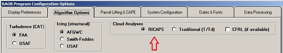
METAR REPORT: When the RICAPS algorithms are activated, you can then activate an additional option to display a complete METAR report at the base of Sounding diagrams.
The above example diagram shows how the RICAPS Donut accurately detects the Snow & Rain precipitation while the adjacent "Precip Type" (or P-Type) nomogram does not.